Subsoil zoning in southern Tamaulipas
DOI:
https://doi.org/10.29059/cienciauat.v19i1.1899Keywords:
geodata, boreholes, zoningAbstract
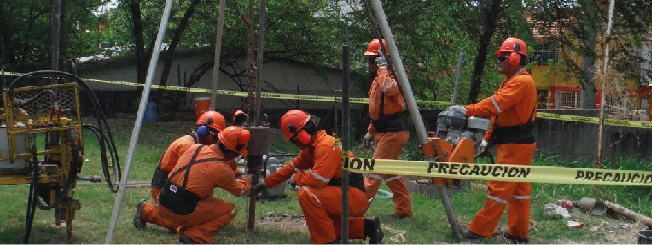
Studying the subsoil is essential in the design and construction of infrastructure. The objective of this work was to zone the subsoil using geographic information systems towards a geotechnical map of southern Tamaulipas. The spatial data were integrated from 347 standard penetration test (SPT) boreholes, derived from 119 geotechnical studies conducted from 2011 to 2018. The generated information enabled the construction of 20 referenced analysis units for the metropolitan area of Altamira, Tampico and Ciudad Madero, developing a zoning map of the subsurface into geotechnical groups: zone A: clays, silts and sands; zone B: sandy clays; zone B’: highly plastic clays and zone C: clayey sand. The information generated through the analysis units and zoning map is projected to be useful for subsequent geotechnical exploration studies.
References
Benavides, O. E. R., Hernández, M. F., Moreno, G. E. y Vilalta, L. O. (1973). El subsuelo de la ciudad de Tampico. En VI Reunión Nacional de Mecánica de Suelos (Ed.), Tomo II. Estado actual del conocimiento. Cimentaciones en áreas urbanas de México: Acapulco, Morelia, Tampico y Yucatán (pp. 1-35). Sociedad Mexicana de Ingeniería Geotécnica, A. C.
Bortolozo, C. A., Motta, M. F. B., Andrade, M. R. M., Lavalle, L. V. A., Mendes, R. M., Simões, S. J. C., Mendes, T. S. G., & Pampuch, L. A. (2019). Combined analysis of electrical and electromagnetic methods with geotechnical soundings and soil characterization as applied to a landslide study in Campos do Jordão City, Brazil. Journal of applied geophysics, 161, 1-14. https://doi.org/https://doi.org/10.1016/j.jappgeo.2018.11.017 DOI: https://doi.org/10.1016/j.jappgeo.2018.11.017
Braja, M. D. (2015). Fundamentos de ingeniería geotécnica. Cengage Learning.
Cariolet, J. M., Vuillet, M., & Diab, Y. (2019). Mapping urban resilience to disasters – A review. Sustainable Cities and society, 51, 101746. https://doi.org/https://doi.org/10.1016/j.scs.2019.101746 DOI: https://doi.org/10.1016/j.scs.2019.101746
Ciurleo, M., Cascini, L., & Calvello, M. (2017). A comparison of statistical and deterministic methods for shallow landslide susceptibility zoning in clayey soils. Engineering geology, 223, 71-81. https://doi.org/https://doi.org/10.1016/j.enggeo.2017.04.023 DOI: https://doi.org/10.1016/j.enggeo.2017.04.023
Failache, M. F. & Zuquette, L. V. (2018). Geological and geotechnical land zoning for potential hortonian overland flow in a basin in southern Brazil. Engineering geology, 246, 107-122. https://doi.org/https://doi.org/10.1016/j.enggeo.2018.09.032 DOI: https://doi.org/10.1016/j.enggeo.2018.09.032
Fern, E. J., Di-Murro, V., Soga, K., Li, Z., Scibile, L., & Osborne, J. A. (2018). Geotechnical characterisation of a weak sedimentary rock mass at CERN, Geneva. Tunnelling and underground space technology, 77, 249-260. https://doi.org/https://doi.org/10.1016/j.tust.2018.04.003 DOI: https://doi.org/10.1016/j.tust.2018.04.003
Gobierno del Estado (2020). Actualización del programa metropolitano de ordenamiento territorial de Altamira, Ciudad Madero y Tampico. [En línea]. Disponible en: https://bit.ly/3RMk1uG. Fecha de consulta: 25 de junio de 2024.
Hipólito-Ojalvo, F., Zamora-Polo, F., Luque, A., & Naharro-Sequeda, I. (2019). Evaluation of subsoil properties of badajoz (Spain) for construction purposes using geographic information systems. Informes de la construcción, 71(556), 1-9. https://doi.org/10.3989/ic.65204 DOI: https://doi.org/10.3989/ic.65204
INEGI, Instituto Nacional de Estadística y Geografía (2018). Diccionario de datos topográficos. Escala 1:20 000. Versión 2. [En línea]. Disponible en: https://bit.ly/3W39rlu. Fecha de consulta: 25 de junio de 2024.
INEGI, Instituto Nacional de Estadística y Geografía (2021). Diccionario de datos topográficos (vectorial). Escala 1:50 000. [En línea]. Disponible en: https://bit.ly/3L9e1bu. Fecha de consulta: 25 de junio de 2024.
Juárez-Camarena, M., Auvinet-Guichard, G., & Méndez-Sánchez, E. (2016). Geotechnical Zoning of Mexico Valley Subsoil. Ingeniería, investigación y tecnología, 17(3), 297-308. https://doi.org/10.1016/j.riit.2016.07.001 DOI: https://doi.org/10.1016/j.riit.2016.07.001
Kang-Tsung, Ch. (2013). Geographic Information Systems. McGraw-Hill Higher Education.
Kim, H. S., Sun, C. G., Lee, M. G., & Cho, H. I. (2021). Multivariate geotechnical zonation of seismic site effects with clustering blended model for a city area, South Korea. Engineering geology, 294, 106365. https://doi.org/https://doi.org/10.1016/j.enggeo.2021.106365 DOI: https://doi.org/10.1016/j.enggeo.2021.106365
Mohan, K., Dugar, S., Pancholi, V., Dwivedi, V. K., Kumar, N., Sairam, B., & Chopra, S. (2024). A multi-scenario based micro seismic hazard assessment of the Bhuj City, western India incorporating geophysical and geotechnical parameters. Quaternary science advances, 13, 100138. https://doi.org/https://doi.org/10.1016/j.qsa.2023.100138 DOI: https://doi.org/10.1016/j.qsa.2023.100138
Napoli, M. L., Festa, A., & Barbero, M. (2022). Practical classification of geotechnically complex formations with block-in-matrix fabrics. Engineering geology, 301, 106595. https://doi.org/https://doi.org/10.1016/j.enggeo.2022.106595 DOI: https://doi.org/10.1016/j.enggeo.2022.106595
Robbins, B. A., Stephens, I. J., & Marcuson, W. F. (2021). Geotechnical Engineering. In D. Alderton & S. A. Elias (Eds.), Encyclopedia of Geology (pp. 377-392). Academic Press. https://doi.org/https://doi.org/10.1016/B978-0-12-409548-9.12508-4 DOI: https://doi.org/10.1016/B978-0-12-409548-9.12508-4
Safani, J. & Matsuoka, T. (2013). Softgeotechnical zone determination using surface wave for geotechnical hazard mitigation. Procedia environmental sciences, 17, 354-360. https://doi.org/https://doi.org/10.1016/j.proenv.2013.02.048 DOI: https://doi.org/10.1016/j.proenv.2013.02.048
Samadian, B. & Fakher, A. (2016). Proposing a framework to combine geological and geotechnical information for city planning in Sanandaj (Iran). Engineering geology, 209, 1-11. https://doi.org/https://doi.org/10.1016/j.enggeo.2016.04.033 DOI: https://doi.org/10.1016/j.enggeo.2016.04.033
SGM, Servicio Geológico Mexicano (2022). Litología. Escala 1:250,000 (ID: 6). [En línea]. Disponible en: https://www.sgm.gob.mx/GeoInfoMexGobMx/#. Fecha de consulta: 26 de junio de 2024.
SGM, Servicio Geológico Mexicano (2024). Zonificación sísmica de México. [En línea]. Disponible en: https://www.sgm.gob.mx/Sismotectonica/. Fecha de consulta: 27 de junio de 2024.
USGS, United States Geological Survey (2019). Landsat 8 (L8). Data Users Handbook. [En línea]. Disponible en: https://www.usgs.gov/media/files/landsat-8-data-users-handbook. Fecha de consulta: 25 de junio de 2024.
Wan-Mohamad, W. N. S. & Abdul-Ghani, A. N. (2011). The use of geographic information system for geotechnical data processing and presentation. Procedia engineering, 20, 397-406. https://doi.org/https://doi.org/10.1016/j.proeng.2011.11.182 DOI: https://doi.org/10.1016/j.proeng.2011.11.182
Zhou, Y., Wu, T., & Wang, Y. (2022). Urban expansion simulation and development-oriented zoning of rapidly urbanising areas: A case study of Hangzhou. Science of the total environment, 807, 150813. https://doi.org/https://doi.org/10.1016/j.scitotenv.2021.150813. DOI: https://doi.org/10.1016/j.scitotenv.2021.150813

Published
How to Cite
Issue
Section
Categories
License
Copyright (c) 2024 Universidad Autónoma de Tamaulipas

This work is licensed under a Creative Commons Attribution-NonCommercial-ShareAlike 4.0 International License.
Accepted 2024-07-09
Published 2024-07-16


